Territorial evolution of Canada
The territorial evolution of Canada describes the process by which the country's provinces and territories were formed and its borders defined over centuries. This history began with European colonization and Indigenous lands, progressed through British and French colonial rivalries, and culminated in the political union of Confederation in 1867. The shifting boundaries reflect Canada's growth from a collection of separate colonies into a transcontinental nation, incorporating vast regions like Rupert's Land. Understanding this evolution is key to appreciating Canada's geographic diversity and its federal structure.
Pre-Confederation Foundations
The story of Canada's borders begins long before 1867, rooted in European exploration and colonial competition. Norse explorers established a short-lived settlement in Newfoundland around the 11th century. Centuries later, John Cabot's 1497 voyage for England staked claims along Newfoundland and Cape Breton, while Jacques Cartier's explorations for France in 1534 laid the foundation for New France along the St. Lawrence River. The fur trade drove much of the early territorial activity, leading to the establishment of the Hudson's Bay Company in 1670, which was granted trading rights over the vast region whose rivers drained into Hudson Bay. The Treaty of Paris in 1763 was a critical moment, transferring all French territories in eastern North America, including New France, to British control. This newly acquired colony of Quebec was initially expansive, but its boundaries were redrawn after the American Revolution, with New Brunswick created as a separate colony for Loyalist refugees in 1784. The Quebec Act of 1774 formally recognized the French language, Catholic religion, and French civil law within the colony, legal foundations that remain in place today. Before being part of British North America, the constituents of Canada consisted of the former colonies of Canada and Acadia from within New France.
Confederation and Western Expansion
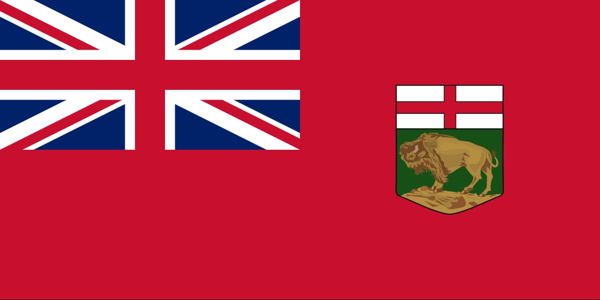
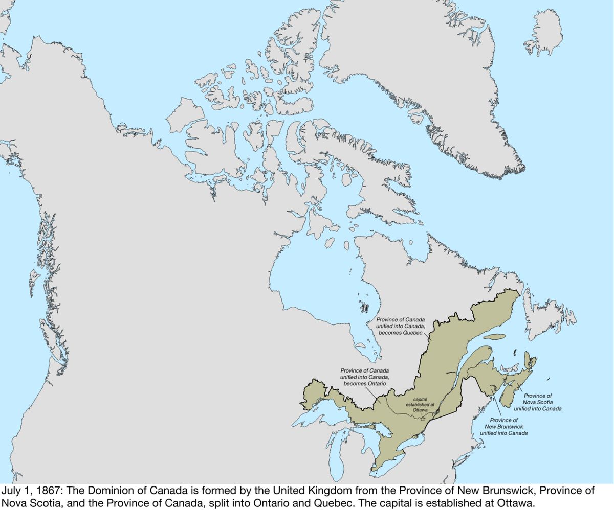
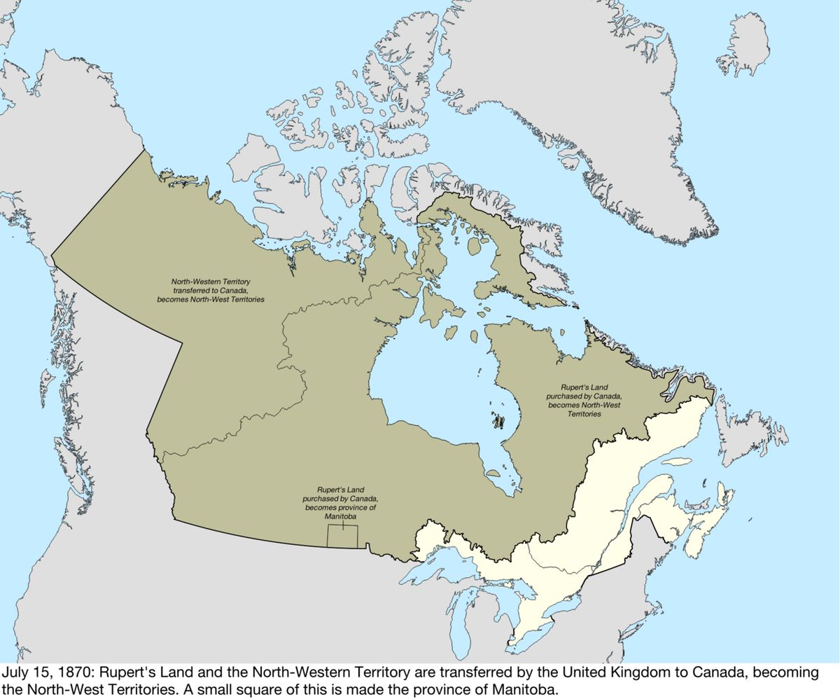
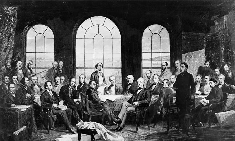
The Confederation of July 1, 1867, united the colonies of Canada, Nova Scotia, and New Brunswick into the Dominion of Canada. The former Province of Canada was immediately split into the new provinces of Ontario and Quebec. This new federation soon began a dramatic westward expansion. In 1870, Canada purchased Rupert's Land and the North-Western Territory from the Hudson's Bay Company. From this immense tract of land, the small province of Manitoba was carved out that same year to address the political situation in the Red River Colony. The remaining lands were organized as the North-West Territories. British Columbia, fearing American encroachment and promised a transcontinental railway, joined Confederation in 1871. Prince Edward Island followed in 1873, completing the initial coastal expansion. The government then faced the task of administering the sprawling North-West Territories, leading to the creation of the District of Keewatin in 1876 for administrative purposes north of Manitoba.
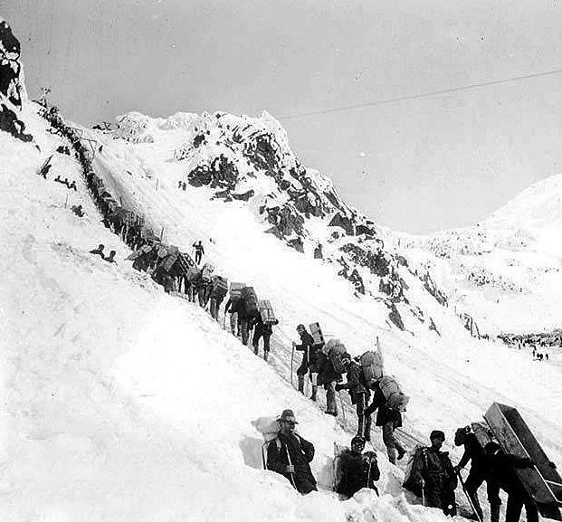
Key developments in this period included the transfer of British Arctic islands to Canada in 1880, which expanded the North-West Territories northward. Manitoba was enlarged westward in 1881 and Ontario was extended northward in 1889, each action reducing the area of the North-West Territories. In 1882, the North-West Territories were divided into the provisional districts of Athabasca, Alberta, Saskatchewan, and Assiniboia for local administration and postal service. The Yukon District was established in 1895 as part of this system, alongside the districts of Mackenzie, Franklin, and Ungava. The influx of prospectors during the Klondike Gold Rush prompted the Canadian government to grant the Yukon District separate territorial status in 1898, providing dedicated governance for the region. This era solidified Canada's claim to a continental territory, though it was administered through a complex and changing system of districts and territories.
Provincial Creation and Northern Extensions
As agricultural settlement boomed on the Prairies, the districts of Alberta and Saskatchewan were made provinces in 1905. Their northern boundaries were set at the 60th parallel. This move prompted demands from the central provinces for similar northern extensions. In 1912, the provinces of Manitoba, Ontario, and Quebec were expanded northward to their present-day boundaries, dramatically reducing the size of the North-West Territories. These extensions were based on watershed boundaries in the east and largely geometric lines in the west. The North-West Territories, now confined to the Arctic and subarctic regions, continued to be administered directly by the federal government. This period completed the map of provincial Canada as it is known today, with the exception of Newfoundland. The table below summarizes the entry of provinces into Confederation.
| Province | Year of Entry | Notes |
|---|---|---|
| Ontario | 1867 | Created from former Province of Canada at Confederation. |
| Quebec | 1867 | Created from former Province of Canada at Confederation. |
| Nova Scotia | 1867 | Founding member of Confederation. |
| New Brunswick | 1867 | Founding member of Confederation. |
| Manitoba | 1870 | Created from Rupert's Land purchase. |
| British Columbia | 1871 | Joined with promise of transcontinental railway. |
| Prince Edward Island | 1873 | Joined after debt negotiations. |
| Alberta | 1905 | Created from part of North-West Territories. |
| Saskatchewan | 1905 | Created from part of North-West Territories. |
| Newfoundland | 1949 | Joined as a province after being a British dominion. |
The addition of Newfoundland in 1949 followed two referendums. This final provincial addition gave Canada its modern complement of ten provinces. Canada only lost significant territory in the border dispute over Labrador with the Dominion of Newfoundland before it joined. The province's entry marked a major late stage in Canada's territorial evolution.
Defining International Borders
While internal boundaries shifted, Canada's international borders were being firmly established through treaties and agreements, primarily with the United States. The Treaty of Paris in 1783 at the end of the American Revolutionary War set the initial boundary along the Great Lakes and the St. Lawrence River. Disputes persisted, leading to the Webster-Ashburton Treaty in 1842, which finalized the border between New Brunswick and Maine and described the boundary from Lake Huron to the Lake of the Woods. West of the Great Lakes, the Convention of 1818 established the 49th parallel as the boundary from the Lake of the Woods to the Rocky Mountains. Beyond the Rockies, the Oregon Country was under joint occupation until the Oregon Treaty of 1846 extended the 49th parallel border to the Pacific Ocean, securing what is now British Columbia for Britain and later Canada. In the far north, a boundary with Russian Alaska was described in an 1825 convention, which later formed the basis of the modern Canada-U.S. border in the Alaska Panhandle. These diplomatic achievements were crucial in preventing conflict and defining the southern and western limits of the nation.
The Evolution of the Territories
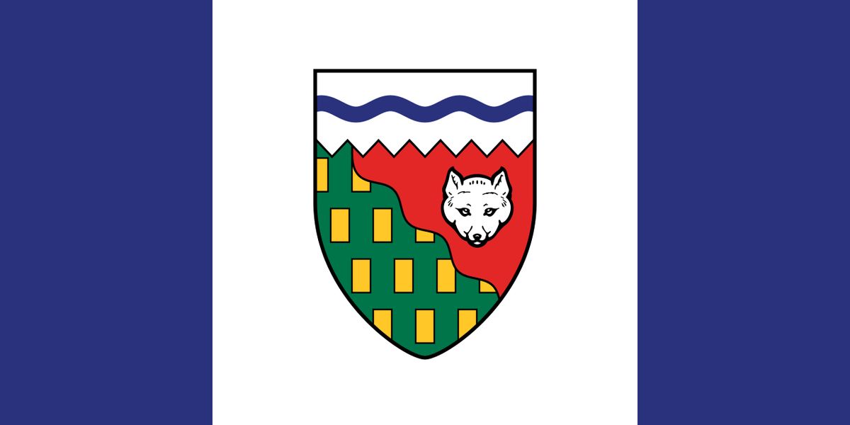
The northern third of Canada has been administered as federal territories, with boundaries evolving significantly over time. After the provincial expansions of 1912, the remaining North-West Territories encompassed the Arctic archipelago and the mainland north of the 60th parallel. For decades, this immense region was governed as a single entity, though its administrative districts like Mackenzie and Franklin remained. In 1999, a landmark change occurred with the creation of Nunavut, a new territory carved out of the eastern portion of the North-West Territories. This change was the result of the largest Indigenous land claim settlement in Canadian history and was designed to respect Inuit traditional concepts of land and self-government. The remaining western portion retained the name Northwest Territories. The Yukon Territory, established in 1898, has maintained a relatively stable boundary since its creation. The evolution of the territories reflects a shift from purely administrative divisions to structures that acknowledge Indigenous rights and self-determination. The current three-territory model represents the latest stage in the political organization of Canada's vast northern regions.
Sovereignty and Modern Context
Canada's journey from a dominion within the British Empire to a fully sovereign state paralleled its territorial consolidation. The Statute of Westminster in 1931 granted Canada and other British dominions complete legal autonomy, though the United Kingdom retained the power to amend Canada's constitution. Full sovereignty was achieved in 1982 with the patriation of the Canadian Constitution, which included the Charter of Rights and Freedoms and formally ended British parliamentary authority. This constitutional milestone occurred decades after the country's geographic form had been largely settled. Modern considerations of territorial evolution include ongoing attention to Arctic sovereignty and the management of offshore boundaries. The historical patterns of boundary-making continue to influence contemporary Canada, from the distinct cultural geography of Quebec, protected since the Quebec Act, to the geometric divisions of the Prairies. The story of Canada's borders is a living framework that shapes provincial relations, resource management, and the ongoing process of reconciliation with Indigenous peoples.
Key Maps and Modern Resources
The complex story of Canada's changing borders is vividly illustrated through historical maps and modern digital tools. Resources like the Atlas of Canada, maintained by Natural Resources Canada, provide detailed animated maps showing the political boundaries from 1867 to 2017. These maps highlight how boundaries in eastern Canada often follow natural features like watersheds, a legacy of early colonial settlement patterns. In contrast, western and northern boundaries frequently follow geometric lines, such as lines of longitude, reflecting later administrative organization. Modern interactive online maps, utilizing standards like MapML, allow users to explore each year's territorial configuration from 1867 onward. These resources are invaluable for educators, historians, and anyone interested in the geographical underpinnings of Canadian history. They visually document the transition from colonial claims to a sovereign federal state. The maps show key shifts such as the purchase of Rupert's Land in 1870, the creation of Alberta and Saskatchewan in 1905, and the establishment of Nunavut in 1999. The online interactive map relies on the MapML standard co-developed by Natural Resources Canada.
Questions about Territorial evolution of Canada
When did Canada become a country and what were the original provinces?
Canada became a country on July 1, 1867, through Confederation. The original four provinces were Ontario, Quebec, Nova Scotia, and New Brunswick. The Province of Canada, which existed before 1867, was split at Confederation to create Ontario and Quebec. This date is celebrated annually as Canada Day, marking the birth of the Dominion within the British Empire.
What was the most recent change to Canada's map?
The most recent major change to Canada's internal map was the creation of the territory of Nunavut on April 1, 1999. Nunavut was carved out of the eastern portion of the existing Northwest Territories. This change was a direct result of the Nunavut Land Claims Agreement, which is the largest Indigenous land claim settlement in Canadian history. The establishment of Nunavut brought Canada to its current total of three territories and ten provinces.
What role did the Hudson's Bay Company play in Canada's territorial history?
The Hudson's Bay Company played a foundational role. Chartered in 1670, it was granted exclusive trading rights over Rupert's Land, a vast territory draining into Hudson Bay. For nearly 200 years, the HBC operated as a de facto government in this region. In 1870, the new Dominion of Canada purchased these lands from the HBC, a transaction that transferred about a third of modern Canada's land mass.
How did Canada acquire its western lands like Alberta and Saskatchewan?
Canada acquired its vast western lands by purchasing Rupert's Land and the North-Western Territory from the Hudson's Bay Company in 1870. This immense acquisition was transferred to Canada and initially administered as the North-West Territories. As settlement increased, the provisional districts of Alberta and Saskatchewan, which were created in 1882, were raised to full provincial status in 1905. This process was part of the broader territorial evolution that followed the 1870 purchase from the Hudson's Bay Company.
Why is the border between Canada and the United States mostly a straight line?
The border is mostly a straight line due to key treaties. The Convention of 1818 set the 49th parallel as the boundary from the Lake of the Woods to the Rocky Mountains. The Oregon Treaty of 1846 then extended this same geometric line west to the Pacific Ocean. This was a practical solution to divide the continent between British and American spheres of influence.
How did Newfoundland become part of Canada?
Newfoundland became part of Canada in 1949 after two referendums. Until then, Newfoundland had been a separate British dominion. This addition brought with it the territory of Labrador, whose border with Quebec had been a subject of long standing dispute. Canada only lost significant territory in the border dispute over Labrador with the Dominion of Newfoundland before it joined.
Sources and further reading
- Territorial evolution of Canada (Wikipedia)
- The Atlas of Canada, Territorial Evolution from 1867 to 2017 (atlas.gc.ca)
- Canada profile, Timeline (bbc.com)
- Historical Boundaries of Canada (thecanadianencyclopedia.ca)
Checked by the Nosy Mag desk. Last updated 2026-10-31.