Tseax Cone
Tseax Cone, also known as the Tseax Volcano, is a small but historically significant volcano located in the Nass Ranges of northwestern British Columbia. It is the site of Canada's deadliest known volcanic eruption, an event that occurred in the last 800 years and devastated the Nisga'a Nation, claiming as many as 2,000 lives. The eruption produced extensive lava flows that cover roughly 36 square kilometres, forming the dramatic lava plain at the heart of Nisga'a Memorial Lava Bed Provincial Park. Today, the volcano is a subject of both scientific study and deep cultural significance. Its potential for future activity also marks it as an important site for understanding volcanic hazards in Canada.
Geography and Environment
Tseax Cone is situated approximately 60 kilometres north of Terrace, British Columbia, near the Nisga'a villages of Gitwinksihlkw and Gitlaxt'aamiks in the Cassiar Land District. It lies within a steep-sided, 5-kilometre-long east-west valley penetrating the Nass Ranges, at the outlet of Melita Lake where Crater Creek flows into the Tseax River. The climate of the area is transitional between coastal and continental regimes, receiving significant moisture from Pacific air that flows through the Skeena River valley or over the Kitimat Ranges. This results in heavy rainfall, cloud cover, and a wetter environment than other parts of the Nass Ranges Ecoregion, though the region can also experience brief periods of extreme cold and deep snow from invading Arctic air masses. The Nass Mountains Ecosection defines the local ecological character, which is characterized by mountainous terrain and numerous streams.
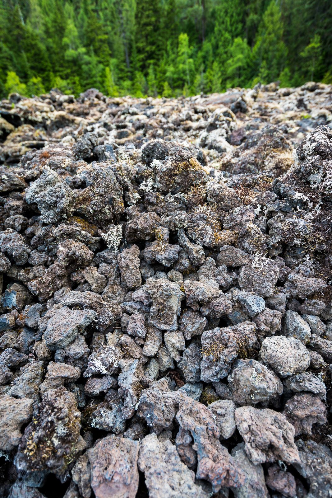
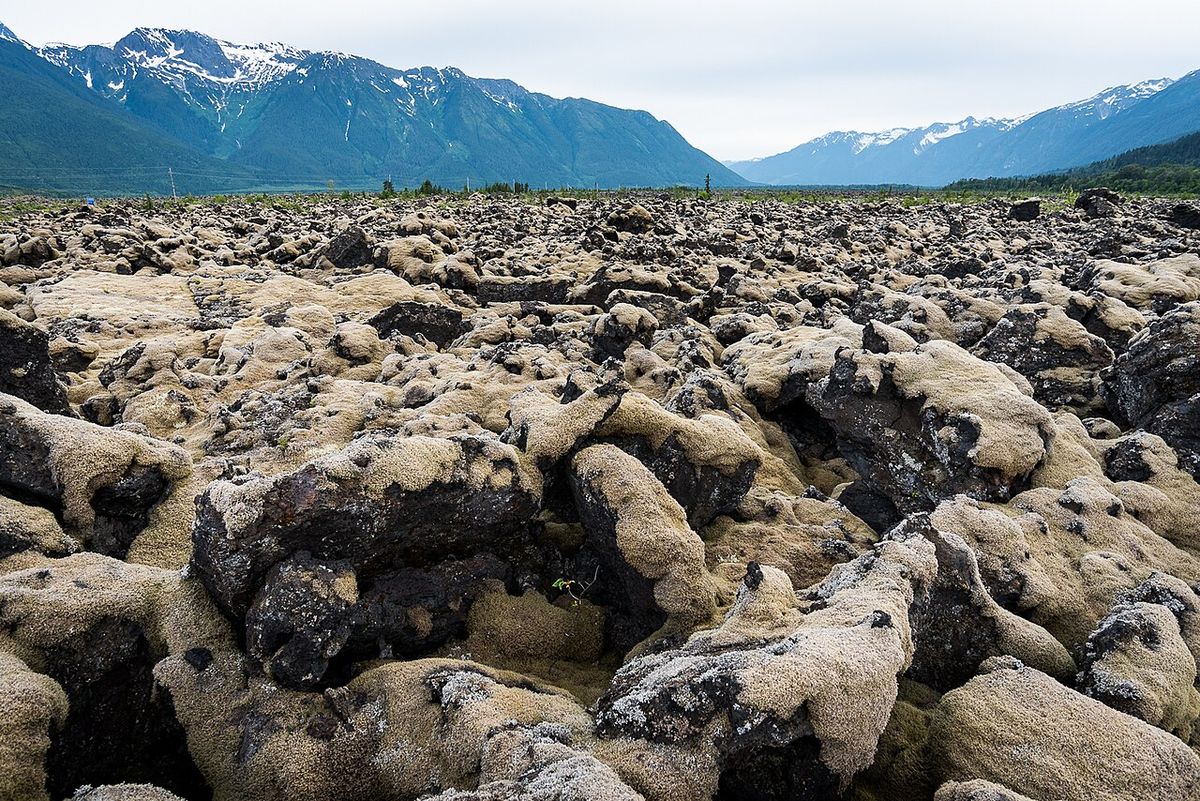
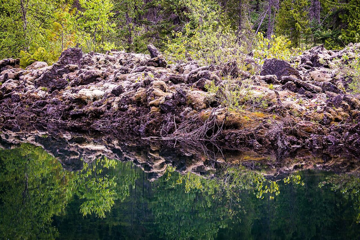
The landscape surrounding the volcano is dominated by the extensive lava flows from its eruption. Large portions of these flows are covered in lichens and mosses ranging in colour from green to yellow, reaching thicknesses of a few centimetres and giving the rock a fur-like appearance. In the Tseax River valley, dense coastal rainforests of coastal western hemlock and subalpine mountain hemlock have almost completely overgrown the lava. Wildlife in the area is typical of the northwestern British Columbia interior and includes species such as marmots, mountain goats, bears, and moose. The growth of lodgepole pine and cottonwood forests on the lava flows is expected to increase through the 21st century due to a milder, wetter climate and silt deposition from local streams.
Geological Context and Structure
Tseax Cone is one of the southernmost volcanoes within the Northern Cordilleran Volcanic Province, a broad zone of volcanic activity extending from northwestern British Columbia northwards through Yukon into eastern Alaska. This province contains shield volcanoes, lava domes, cinder cones and stratovolcanoes formed by eruptions from 20 million years ago to a few hundred years ago. Volcanism here is attributed to rifting of the North American Cordillera, driven by changes in relative plate motion between the North American and Pacific plates. The cone itself is a nested structure consisting of two main parts built unconformably upon grey sandstones and dark conglomerates, siltstones and mudstones of the Jurassic-Cretaceous Bowser Lake Group.
An older external spatter rampart, about 460 metres in diameter and 15-25 metres high, was formed by Hawaiian-style lava fountaining and consists of reddish to black spatter and scoria. Located within it is a younger inner cone, 290 metres in diameter and 65-75 metres high, created by low-intensity Strombolian explosions and containing a crater roughly 80 metres across and 33 metres deep. The volcano's eruptive products are basanitic, trachybasaltic, or alkali basaltic in composition, rich in iron-titanium oxides with phenocrysts of olivine and plagioclase. They originated from a low degree of partial melting about 55-62 kilometres below the surface in the upper crust. Approximately 470 metres north of the main cone, on the opposite side of Melita Lake, lies a smaller, heavily oxidized satellite cone about 20 metres high and 50-55 metres in diameter with a summit crater 4 metres deep. An eruptive fissure with three or four tephra mounds extends southwest from this satellite cone.
The Eruption and Its Lava Flows
The eruption from Tseax Cone produced four distinct lava flows, likely emplaced over a period of weeks to a few months during a single eruptive episode. The first and most voluminous flow accounts for about 84 percent of the total 0.5 cubic kilometres of erupted material, a volume comparable to Mauna Loa's 1984 eruption. It travelled 31.6 kilometres through the Crater Creek and Tseax River valleys to the Nass River, forming a lava plain 3 kilometres wide and 12 kilometres long with an elevation of about 50 metres. This flow was likely substantial enough to temporarily dam the Nass River. The second flow, representing about 13 percent of the volume, travelled 21.6 kilometres through Crater Creek valley to near the mouth of the Tseax River valley. These first two flows are pāhoehoe type lava, poor in phenocrysts, and originated from the spatter rampart.
The third and fourth flows are shorter, ʻaʻā type lavas rich in phenocrysts that issued from the inner cone. The third flow accounts for less than 2 percent of the volume and travelled 7.2 kilometres to near Ross Lake. The fourth flow, the shortest and least voluminous at about 1 percent of the total, travelled 5.3 kilometres down Crater Creek. All flows contain features like intact and collapsed lava tubes and lava tree molds. At least four lava tubes are situated adjacent to the cone at an elevation of 590 metres. A 1975 glaciological study found two of these tubes were ice-free most of the year, one containing a small braided stream, while the other two were blocked by permanent ice floors with up to 20 centimetres of water on top in summer.
- First Flow: Longest and most voluminous (84%), travelled 31.6 km to the Nass River, likely dammed the river.
- Second Flow: Represented 13% of volume, travelled 21.6 km to the Tseax River valley mouth.
- Third Flow: Accounted for less than 2% of volume, travelled 7.2 km to near Ross Lake.
- Fourth Flow: Shortest and least voluminous (about 1%), travelled 5.3 km down Crater Creek.
The eruption of the Tseax Cone lava flows had a radical impact on the landscape due to their sudden inundation of the Tseax River valley and the Nass River floodplain. Damming of Crater Creek and the Tseax River resulted in Melita Lake and Lava Lake ponding behind the lava flows, although Lava Lake had already existed before the lava was erupted and merely increased in depth. The Tseax River was forced to abandon its alluvial channel in favour of bedrock channels along the lava flows, although in some places one or more channels flow on the lava. Vetter Creek, a tributary of the Nass River, flows along the western side of the lava and then disappears under the lava-covered Nass River floodplain through a series of sinkholes. The lower portions of several alluvial fans are buried under the lava flows, including the Vetter fan which is among the largest.
Dating the Eruption and Age Controversy
Determining the precise date of the Tseax Cone eruption has been challenging due to the absence of direct written accounts. Nisga'a oral history, recorded by missionaries as early as the 1910s, suggests an eruption around 1770, though the credibility of these early translations has been disputed. Early scientific observations, like G. Hanson's 1923 report of 170-year-old trees growing on the lava, pointed to an event prior to 1753. In 1935, Marius Barbeau concluded the latest eruption occurred in the late 18th century. A 1977 speculation that naval officer Juan Francisco de la Bodega y Quadra witnessed the eruption in 1775 is considered extremely unlikely given his location over 280 kilometres away.
Radiocarbon dating of materials affected by the eruption has yielded a wide range of ages, contributing to ongoing debate. Dates have ranged from as old as 625 ± 70 years from a charred tree trunk in the spatter rampart wall to as young as 190 ± 15 years. A lava-encased cottonwood near the Nass River yielded dates of 220 ± 130 years and a corrected date of 230 ± 50 years. Michael D. Higgins recalibrated these in 2008 to suggest an eruption between 1668 and 1714, and also proposed the 1700 Cascadia earthquake may have triggered the event by destabilizing magma. Recent research has helped narrow the timeframe. A 2020 study reported radiocarbon dates of 190 ± 15 years and 390 ± 15 years from charred wood beneath tephra, suggesting the eruption occurred between 1675 and 1778. The Smithsonian Institution's Global Volcanism Program lists a date of 1690 ± 150 years for the last known eruption.
There has also been controversy over whether the cone formed in a single eruptive episode or multiple events. G. Hanson proposed a single eruption in 1923, as did Sutherland Brown in 1969. Vilho Wuorinen argued in 1978 for two distinct episodes based on differences in surface erosion, vegetation cover, and the 625 ± 70 year radiocarbon date. However, most subsequent research, including new data reported in 2020, supports the hypothesis that the cone and its lava flows were formed during one episode of activity. The timing of volcanism makes Tseax Cone one of the youngest volcanoes in Canada and the site of one of the country's most recent eruptions.
Impact on the Nisga'a Nation and Cultural Significance
The eruption of Tseax Cone was a catastrophic event for the Nisga'a Nation, whose territory encompasses the volcano. Oral histories describe the destruction of villages along the Nass River and the deaths of many people from inhaling volcanic fumes, with some accounts stating as many as 2,000 lives were lost. This death toll would make it the deadliest geological disaster in Canadian history and the second-worst natural disaster in the country by number of fatalities. The eruption forced survivors to abandon their homes and relocate, shaping the settlement patterns of the Nisga'a people. The volcano is known in the Nisga'a language as Wil Ksi Bax̱hl Mihl, meaning 'Where the Fire Ran Out', a direct reference to the lava flows.
The lava beds left by the eruption are central to Nisga'a history and identity. After at least 20 years of pleas for protection, the area was established as the Nisga'a Memorial Lava Bed Provincial Park in 1992. The 17,717-hectare protected area is the first provincial park in British Columbia to be co-managed by BC Parks and a First Nation. In recent years, Nisga'a knowledge has played a major role in scientific understanding. A collaborative research project beginning in 2016 combined generations of Indigenous oral history with geological data to create a detailed map of the volcano and its flows, confirming the extent and speed of the eruption described in Nisga'a traditions.
Scientific Research and Modern Understanding
Scientific study of Tseax Cone has evolved significantly since early geological surveys. The collaborative research project involving Quest University, Simon Fraser University, and the University of British Columbia, which actively incorporated Nisga'a knowledge, produced a detailed map of the volcano. This map revealed that the lava plain extends 32 kilometres, providing new data on the eruption's scale and confirming oral histories about the rapid flow that destroyed villages. Researchers use this information to model details such as the eruption's duration and the height of its volcanic plume, which aids in understanding future volcanic hazards in the region.
Tseax Cone is considered an active volcano within the seismically active Northern Cordilleran Volcanic Province, which contains over 100 volcanoes. Its location on a volcanic belt stretching 1,200 kilometres to Alaska means insights gained here help understand volcanic risks across a wide area. The volcano's lava has a liquidus viscosity comparable to basalts from Mount Etna and Hawaii, as well as the fast-moving lavas of Mount Nyiragongo, suggesting future eruptions could produce similarly fast-moving flows. The magma may have risen along the same faults as the Lakelse Hot Springs south of Terrace, the hottest geothermal springs in Canada. Potential hazards from a renewed eruption include starting wildfires and blocking local streams with lava flows, which could impact communities and ecosystems in the Nass Valley.
Accessibility, Tourism and Names
Tseax Cone and the surrounding Nisga'a Memorial Lava Bed Provincial Park are accessible via provincial highways and backcountry roads north of Terrace, British Columbia. The park protects the dramatic volcanic landscape and serves as a place of remembrance and education. Visitors can observe the vast lava fields, lava tube caves, and the volcanic cones themselves. The area offers a unique opportunity to witness the powerful intersection of natural forces and human history. Guided tours, such as the Tseax Lava Cone Tour, are occasionally offered by park authorities, providing interpretive context about the geological features and the Nisga'a history intertwined with the land. The volcano has been variously called Aiyansh Volcano, Aiyansh River Volcano, Tseax River Cone and Tseax Volcano. 'Aiyansh' comes from a Nisga'a word meaning 'leafing early', while 'Tseax' means 'new water', possibly referring to the disturbed drainage from the eruption. The name Tseax Cone became official on December 13, 1991, and was adopted on National Topographic System map 103P/2. When visiting, it is important to recognize that the landscape is a cultural memorial and to tread respectfully. The Nisga'a villages of Gitwinksihlkw and Gitlaxt'aamiks are the nearest communities to the park.
Questions about Tseax Cone
When did the Tseax Cone volcano erupt?
The exact date remains uncertain due to a lack of written records, but the eruption occurred sometime in the last 800 years. Radiocarbon dating and Nisga'a oral history point to an event between 1675 and 1778, with a commonly cited approximate date of 1690 ± 150 years. This makes it one of the most recent volcanic eruptions in Canada. Recent research from 2020 using charred wood samples supports an eruption window within that period.
How many people died in the Tseax Cone eruption?
Nisga'a oral histories and subsequent research indicate the eruption was devastating, with estimates of up to 2,000 lives lost. This makes it the deadliest known geological disaster in Canadian history and the second-worst natural disaster in the country by death toll. The primary cause of death is believed to be the inhalation of volcanic gases, particularly carbon dioxide. The event led to the loss of at least three Nisga'a villages named Lax Ksiluux, Lax Ksiwihlgest and Wii Lax K'abit.
Where is Tseax Cone located?
Tseax Cone is located in northwestern British Columbia, approximately 60 kilometres north of Terrace. It lies within the Nass Ranges of the Hazelton Mountains, near the Nisga'a villages of Gitwinksihlkw and Gitlaxt'aamiks in the Cassiar Land District. The volcano sits in a steep-sided, 5-kilometre-long east-west valley at the outlet of Melita Lake, where Crater Creek flows into the Tseax River. The volcano and its lava flows are protected within the Nisga'a Memorial Lava Bed Provincial Park.
Is Tseax Cone still an active volcano?
Yes, Tseax Cone is considered an active volcano. It is part of the Northern Cordilleran Volcanic Province, which remains seismically active. While it has not erupted in roughly 250 years, the potential for future activity exists. Scientists monitor the region to better understand the hazards, which could include fast-moving lava flows and wildfires. The volcano is located on a volcanic belt containing over 100 other volcanoes, so understanding its past behaviour helps assess regional risk.
What does the name 'Tseax' mean?
The name 'Tseax' comes from a Nisga'a word meaning 'new water'. It is likely a reference to the significant changes in local drainage patterns caused by the volcanic eruption, which dammed rivers and created new lakes. The Nisga'a name for the volcano itself is Wil Ksi Bax̱hl Mihl, which translates to 'Where the Fire Ran Out'. The official name Tseax Cone was adopted by the Canadian government on December 13, 1991.
Can you visit Tseax Cone?
Yes, the volcano and its extensive lava flows are located within Nisga'a Memorial Lava Bed Provincial Park, which is accessible by road from Terrace. The park features viewing areas and interpretive information. Access to Tseax Cone itself is limited to a 6-kilometre guided hiking tour from an access road north of the Lava Lake picnic site on the Nisga'a Highway. The park is the first in British Columbia to be co-managed by BC Parks and a First Nation.
Sources and further reading
- Tseax Cone (Wikipedia)
- Nisga'a knowledge helps scientists create first detailed ... (cbc.ca)
- Posted on October 5, 2026, BC Parks Blog (engage.gov.bc.ca)
- The Canadian wilderness eruption: Tseax volcano (volcanocafe.org)
Checked by the Nosy Mag desk. Last updated 2026-10-29.