Castle Frank Brook
Castle Frank Brook is a historical watercourse and buried tributary of the Don River in Toronto, Ontario. Originally flowing from the Lawrence Avenue and Dufferin Street area to the Don River south of the Prince Edward Viaduct, its path carved the ravines of Cedarvale, Nordheimer, and Rosedale Valley. The brook is named for Castle Frank, the summer residence of Upper Canada's first lieutenant-governor, John Graves Simcoe, which he named for his son, Francis. Today, nearly the entire stream is buried within Toronto's storm sewer system, yet its topographic legacy continues to shape neighbourhoods, parks, and transit routes in the city's core.
Geography and Course
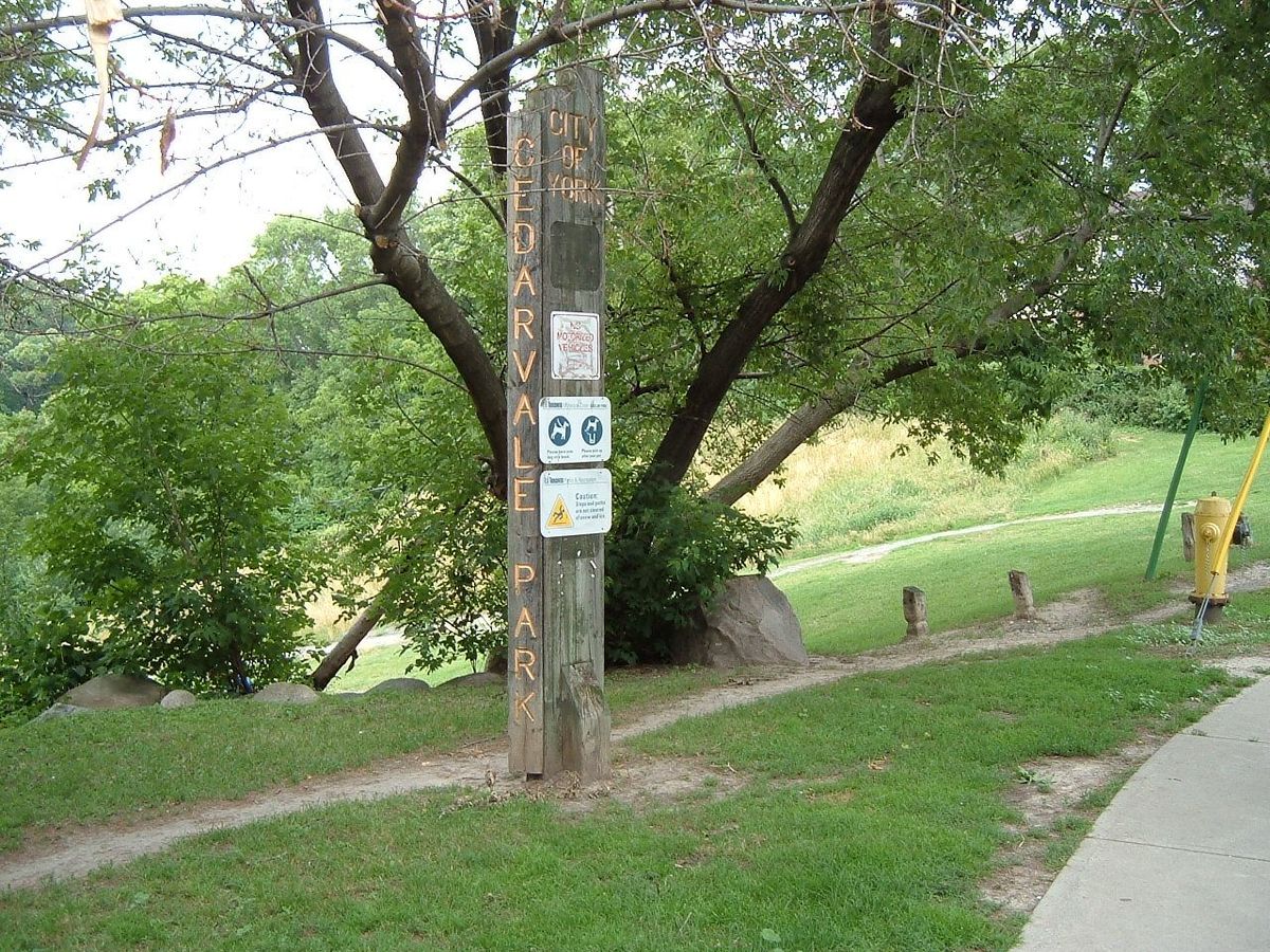
Castle Frank Brook originated in the area near modern Lawrence Avenue and Dufferin Street, within what was historically the City of North York. Its total course spanned roughly twelve kilometres. The brook flowed in a general south-westerly direction towards the Don River. Its journey carved a distinct valley system through the glacial till of the area, creating a series of connected ravines that remain prominent landscape features despite the brook's burial. The waterway's original topography is most evident in the lower reaches, where the steep-sided valleys of Cedarvale Park, Nordheimer Ravine, and Rosedale Valley resisted complete urban infill.
The brook's course is conventionally divided into five distinct reaches, each corresponding to a major segment of its path and the neighbourhoods it traversed. The Fairbank Reach constituted the uppermost section, flowing from the headwaters to Cedarvale Park. The Cedarvale Ravine Reach encompassed the park and ravine down to St. Clair Avenue West. The Nordheimer Ravine Reach continued from St. Clair to the Canadian Pacific Railway tracks near Davenport Road. The Yorkville Reach passed through the historic village of Yorkville to the Sherbourne Street bridge. Finally, the Rosedale Valley Reach followed the deep ravine to the brook's confluence with the Don River just south of the Bloor Street Viaduct.
- Fairbank Reach: From headwaters (Lawrence/Dufferin) to Cedarvale Park.
- Cedarvale Ravine Reach: Through Cedarvale Park to St. Clair Avenue West.
- Nordheimer Ravine Reach: From St. Clair Avenue West to CPR tracks at Davenport Road.
- Yorkville Reach: Through former Yorkville to Sherbourne Street bridge.
- Rosedale Valley Reach: Through Rosedale ravine to the Don River.
Major tributaries included Cedarvale Stream, Forest Hill Stream, and Mashquoteh Creek, among others. The brook's valley exerted a lasting influence on Toronto's urban form. Vaughan Road was constructed to bypass the steep slopes of the Cedarvale ravine, and the Toronto Transit Commission's Spadina subway line runs in the former creek bed between Cedarvale and St. Clair West stations. The brook's topographic influence is also evident at Ramsden Park, north of Avenue Road and Davenport Road, marking the boundary of the Yorkville district. Today, only short, artificial channels in Cedarvale Park and Nordheimer Ravine carry surface runoff and seepage into the storm sewer system that now contains the brook.
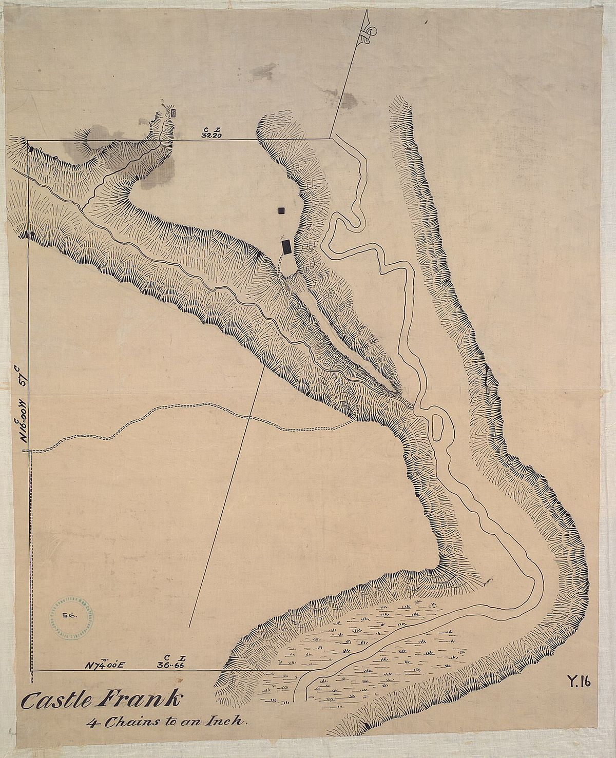
Castle Frank: The Namesake Residence
The brook derives its name from Castle Frank, the summer homestead of Lieutenant-Governor John Graves Simcoe and his wife, Elizabeth. In 1793, Simcoe obtained a 200-acre land grant on the west bank of the Don River, registered in the name of his young son, Francis Gwillim Simcoe. The family sought a retreat from the fledgling Town of York, and Elizabeth Simcoe described the chosen site as a high spot overlooking the tops of large trees within large pine plains. Simcoe directed soldiers of the Queen's Rangers to clear land and construct a log building, which was completed in 1794.
The structure was a unique and ambitious design for the frontier, modelled on a classical Greek temple. It featured porticos on two sides supported by four large, peeled pine log pillars, each about sixteen feet high. The exterior walls were left unpainted, and the interior consisted of only two rooms, each with a fireplace. The residence commanded an unobstructed view of the Don Valley and was connected to York by a path that later became part of Parliament Street. The family's use of the cottage was brief, as Simcoe's tenure as lieutenant-governor ended and they returned to England in 1796. The five-year-old Francis never saw the home again. He later joined the British Army and was killed in 1812 during the Siege of Badajoz in Spain at age 22.
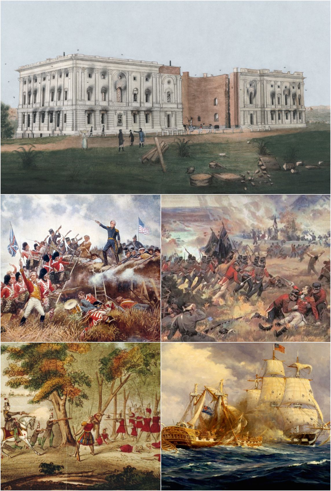
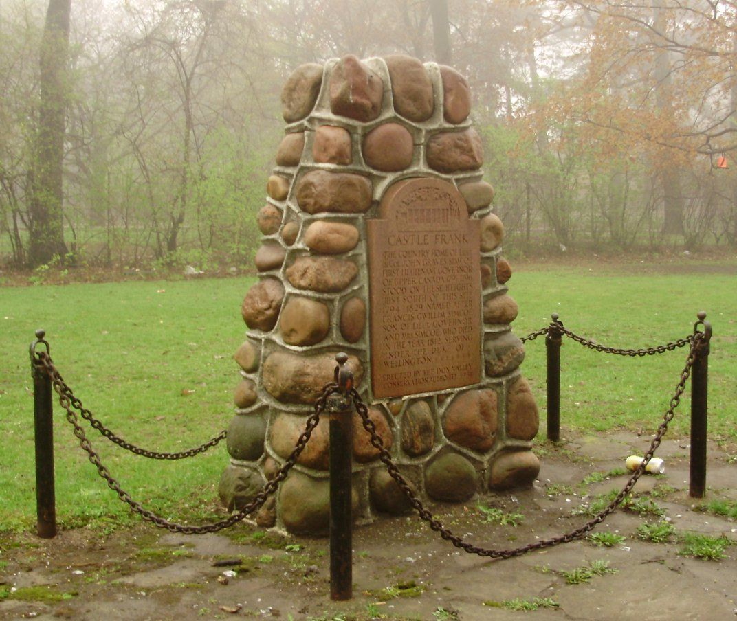
After the Simcoes' departure, the property fell into decline. It was used occasionally for picnics by officials like Administrator Peter Russell and was loaned to militia officer John Denison. By 1803, visitors like Colonel Thomas Talbot reported it was uninhabited and 'going to ruin,' having been vandalized. During the War of 1812, American troops occupying York sought out the 'castle' marked on maps, only to find a derelict cabin. In 1829, the structure was accidentally burned down by amateur fishermen using it for shelter. The original site, near the modern Prince Edward Viaduct, is commemorated by a historical marker erected in the nearby parkette in 1954. The site can be seen from aerial photos as a partially cleared area with a ring-like shape.
Industrialization, Burial, and Alternate Names
Residential and industrial development in the former cities of York and North York gradually obliterated the natural stream, especially in its upper reaches. The waterway was known by another name that reflected its changing context. For a time, it was called Severn Creek after local brewer John Severn, who operated breweries in Toronto, San Francisco, and Davenport, Iowa during his brief absence from Toronto from 1858 to 1863. The process of burying the creek was part of a broader municipal effort to manage stormwater and open up land for development. Nearly the entire length of Castle Frank Brook was channelized into underground storm sewers. This engineering work erased the surface stream but preserved the ravine corridors as parkland and green spaces in many areas. The burial was so complete that today, only isolated, artificially maintained channels in Cedarvale and Nordheimer Ravines hint at the former watercourse, and these carry only urban runoff.
Enduring Topographic and Cultural Legacy
Although buried, Castle Frank Brook left an indelible mark on Toronto's physical and cultural scene. The ravines it carved remain vital green corridors and recreational spaces, such as Cedarvale Park and the Rosedale Valley. These areas are now protected as part of the city's ravine system. The brook's valley directly influenced road and transit routing. Vaughan Road skirts the edge of the Cedarvale ravine, and the Spadina subway line runs within the old creek bed for a segment of its route, a direct legacy of the easier grade provided by the natural valley.
The Castle Frank name persists across the city in several forms. Castle Frank Road leads to Castle Frank subway station, which opened in 1966 at Bloor Street East. A second grand home named Castle Frank was built north of the original site by Sir Albert Edward Kemp, a Conservative MP and minister. This 24-room manor stood until 1962, when it was demolished to make way for what is now Rosedale Heights School of the Arts. The name also appears on local businesses and continues to be a point of historical interest, featured in community events like Simcoe Day walking tours that explore Toronto's early history.
Contemporary Recognition and Restoration
In recent decades, there has been growing recognition of the historical and ecological significance of buried watercourses like Castle Frank Brook. Community and environmental groups have undertaken projects to restore aspects of the ravine ecosystems it created, even if the brook itself cannot be daylighted. These efforts often focus on removing invasive, non-native plant species and replanting with native vegetation to improve biodiversity and habitat within the ravine parks. The specific site of the original Simcoe residence can sometimes be identified in aerial photographs as a faint, ring-like clearing in the Don Valley woods, a ghostly imprint of the province's early colonial history.
The story of the brook and its namesake cottage is kept alive through historical plaques, local history blogs, and public lectures. Events such as Simcoe Day commemorations often include the history of Castle Frank as part of Toronto's architectural origin story. Restoration initiatives demonstrate ongoing civic engagement with these landscapes. This ongoing engagement ensures that the legacy of Castle Frank Brook, as both a physical landformer and a cultural landmark, remains a part of Toronto's collective memory.
Questions about Castle Frank Brook
What happened to the original Castle Frank house?
The original pine log house was abandoned when the Simcoe family returned to England in 1796. It fell into disrepair and was occasionally used by others. In 1829, the structure was accidentally burned down by amateur fishermen who were using it. A historical marker was placed near the site in Prince Edward Viaduct Parkette in 1954.
Where is Castle Frank Brook located?
Castle Frank Brook is a buried creek and tributary of the Don River in central and north western Toronto, Ontario. It originates near the intersection of Lawrence Avenue and Dufferin Street and flows southwest for approximately twelve kilometres to its confluence with the Don River south of the Prince Edward Viaduct. The stream valley remains evident in several older districts bordering its lower reaches, including Cedarvale Park ravine, Nordheimer Ravine, and Rosedale Ravine. The Toronto Transit Commission's Spadina subway line follows the path of the creek from Cedarvale station to St. Clair West station.
Why is it called Castle Frank Brook?
The brook is named for Castle Frank, the summer residence of Upper Canada's first lieutenant-governor, John Graves Simcoe. Simcoe named the residence for his son, Francis Gwillim Simcoe. The original log cabin was built on a 200-acre land grant on the west bank of the Don River, registered in his son's name. The name was later applied to the nearby waterway.
Can you see Castle Frank Brook today?
Castle Frank Brook is almost entirely buried beneath the city within Toronto's storm sewer system. Short, artificially created channels exist in Cedarvale Park and the Nordheimer Ravine, but these only carry surface runoff and ravine slope seepage into the underground pipes. The most visible remnants are the original stream valleys the brook carved, which remain as major parklands like Cedarvale Park and Rosedale Valley. The brook's topographic influence is also evident at Ramsden Park, representing the boundary of the Yorkville district.
How did Castle Frank Brook influence Toronto's development?
The brook's deep ravines significantly influenced Toronto's infrastructure and urban geography. Vaughan Road was built to bypass the steep slopes of the Cedarvale ravine. The Spadina subway line follows the path of the creek from Cedarvale station to St. Clair West station. The valleys also became valuable green space, preserved as parks. The brook's burial was part of the city's expansion and stormwater management efforts.
Are there any restoration projects for Castle Frank Brook?
The brook itself is not being restored to the surface. However, there are ongoing ecological restoration projects within the ravine parks it created, such as Cedarvale Park and Nordheimer Ravine. These projects focus on removing invasive plant species and reintroducing native vegetation. Their goal is to improve the health and biodiversity of these significant urban green corridors, which are the main legacy of the buried waterway.
Sources and further reading
- Castle Frank Brook (Wikipedia)
- Castle Frank Brook (lostrivers.ca)
- Castle Frank (thecanadianencyclopedia.ca)
- Castle Frank Brook (readtheplaque.com)
Checked by the Nosy Mag desk. Last updated 2026-10-27.