History of Yukon
The history of Yukon covers the period from the arrival of Paleo-Indians through the Beringia land bridge approximately 20,000 years ago. In the 18th and 19th centuries, Russian explorers and the Hudson's Bay Company established trade networks. The Klondike Gold Rush prompted the creation of the Yukon Territory in 1898. Subsequent developments include the construction of the Alaska Highway and modern land claim agreements with First Nations.
Ancient Foundations and First Nations
The earliest evidence of human presence in Yukon dates back approximately 20,000 to 40,000 years, linked to the Beringia land bridge that connected Asia and North America during the last ice age. This unglaciated region was home to now-extinct megafauna like woolly mammoths and giant beavers, hunted by Paleo-Indians whose modified animal bones have been found near Old Crow. Around AD 800, a large volcanic eruption from Mount Churchill deposited ash across southern Yukon, an event recorded in both geological layers and First Nations oral histories. This cataclysm is believed by some anthropologists to have spurred migrations, including the southward movement of Athabaskan peoples.
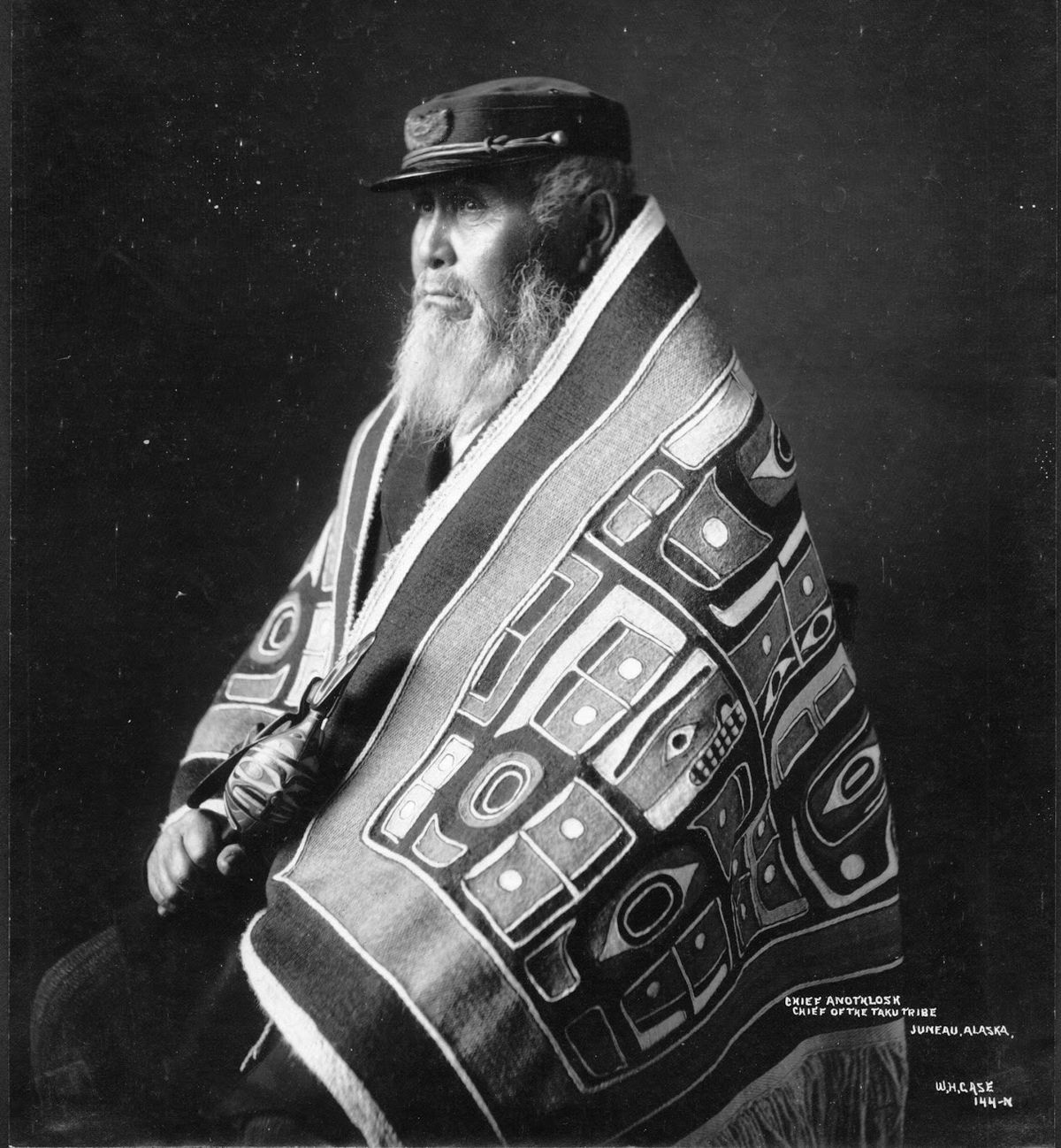
By the 19th century, the Yukon was home to a diverse array of Indigenous nations with distinct territories and complex trade networks. The Athabaskan-speaking Gwich'in lived in the Peel and Porcupine River basins in the north, while the Hän people resided along the central Yukon River near the Alaska border. The Northern and Southern Tutchone occupied the central and south-western regions respectively, with the Kaska in the south-east near the Liard River and the Tagish near southern lakes. The Upper Tanana lived in the White River headwaters, and the Tlingit had a presence along the Teslin River. The Arctic coast, including Herschel Island, was inhabited by Inuit. Estimates of the population at the beginning of the 19th century vary between about 4,700 and over 9,000 people.
Fur Trade and European Incursion
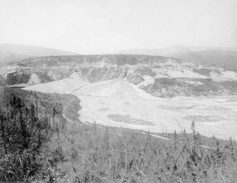
European exploration and the fur trade began shaping Yukon in the first half of the 19th century, primarily driven by the Hudson's Bay Company. Explorers used two main routes from established posts in the Mackenzie River district. The northern route, pioneered by John Bell in 1845, went from Fort McPherson over the mountains to the Bell and Porcupine Rivers, reaching the Yukon River. The southern route followed the Liard River to Frances Lake and then the Pelly River to the Yukon. Alexander Hunter Murray established key posts at Lapierre House in 1846 and Fort Yukon in 1847, though the latter was later found to be inside Russian Alaska. From the south, Robert Campbell explored extensively and built Fort Frances on Frances Lake in 1842 and Fort Selkirk at the confluence of the Yukon and Pelly Rivers in 1848. Fort Selkirk was sacked by Tlingit warriors from the coast in 1852 over trade disputes and was not reestablished until 1889. Missionaries followed the traders, with figures like Anglican Bishop William Carpenter Bompas and Catholic Oblates of Mary Immaculate establishing a lasting religious presence.
The Klondike Gold Rush and Territorial Birth
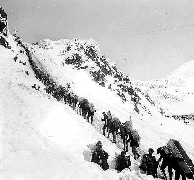
The discovery of gold on Bonanza Creek by Skookum Jim Mason, George Carmack, and Dawson Charlie on 17 August 1896 ignited the Klondike Gold Rush, the defining event in Yukon's history. News reached the outside world in 1897, triggering a massive influx of an estimated 30,000 to 40,000 prospectors during the winter and spring of 1897 to 1898. This sudden population boom, dominated by American stampeders, prompted the Canadian government to assert control. The Yukon District had been carved from the North-West Territories in 1895, and on 13 June 1898, the Yukon Territory was officially created by an act of Parliament.
The rush altered the region almost overnight. Dawson City swelled to become the largest city west of Winnipeg, and the need for transportation led to the construction of the White Pass and Yukon Route railway, completed in 1900. The influx also spurred subsidiary rushes in Atlin, British Columbia, and Nome, Alaska. By 1901, the territorial population was recorded at 27,219, a number not matched again until 1991. The event is commemorated annually by Yukon's Discovery Day statutory holiday, observed on the third Monday of August. In 2026, Discovery Day falls on 17 August.
- 17 August 1896: Gold discovered on Bonanza Creek.
- 1897 to 1898: Peak of the stampede to the Klondike.
- 13 June 1898: Yukon Territory established.
- 1900: Completion of the White Pass and Yukon Route railway.
- 1901: Territorial census records 27,219 people.
- Annual: Discovery Day holiday (third Monday in August).
Post-Gold Rush Decline and Mid-Century Developments
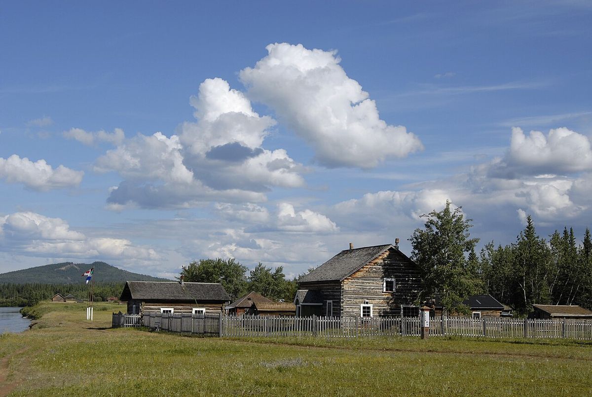
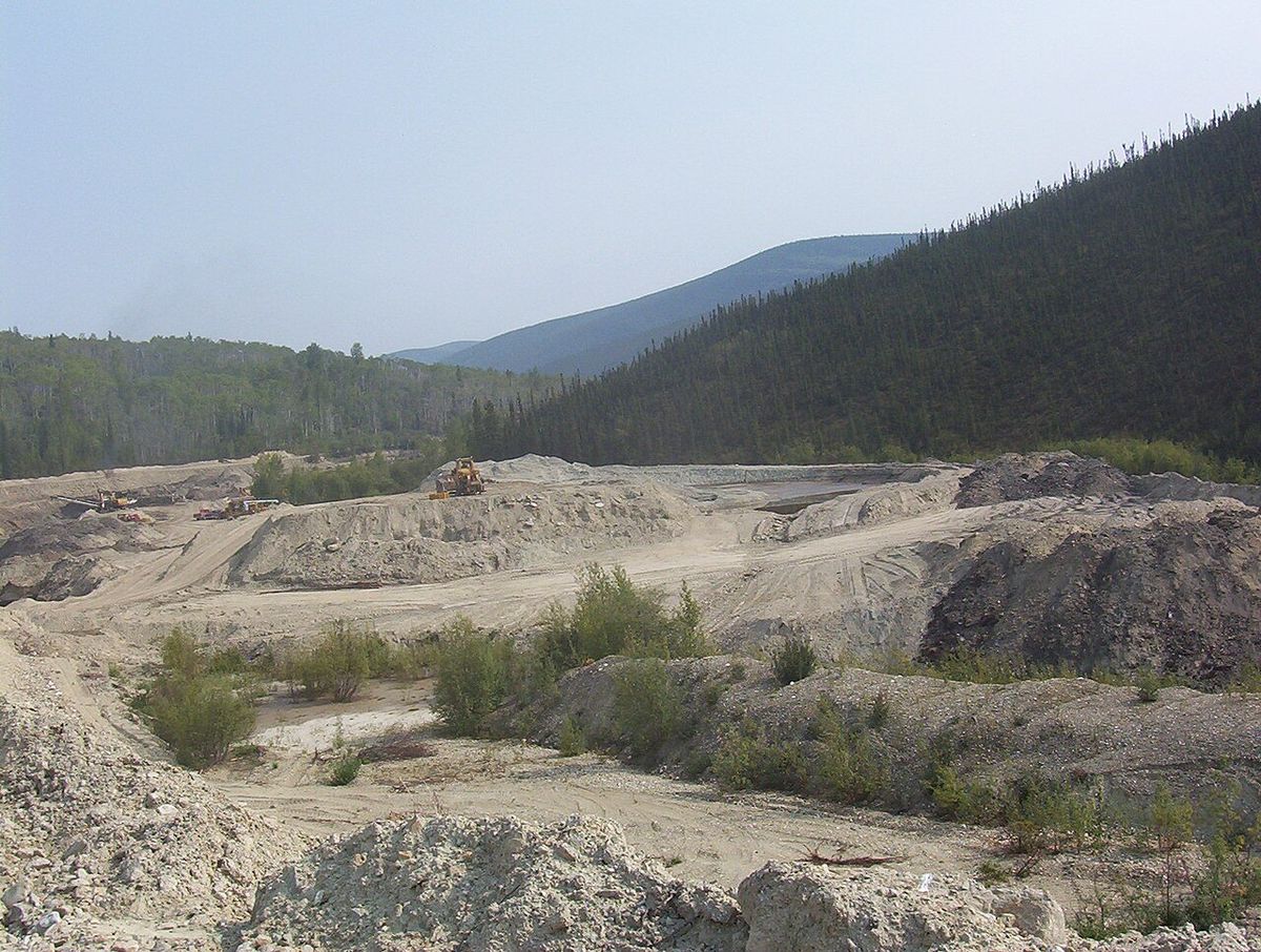
After the gold rush frenzy subsided, Yukon's population plummeted, reaching a low of 4,157 by 1921. Mining continued but became more industrialized, as individual claims in the Klondike were consolidated by companies like the Guggenheim's Yukon Gold Corporation, which used large floating dredges. The Yukon Consolidated Gold Company continued dredging operations into the 1960s. Other mineral developments included silver near Mayo, copper near Whitehorse, and a brief period of prosperity in the 1930s when the price of gold rose. By 1920, the elected territorial council was reduced to three members, with effective control resting with a federally appointed Gold Commissioner.
The construction of the Alaska Highway during the Second World War opened up the territory to road traffic. After its reconstruction in the late 1940s, it played an extremely important role in the acculturation of the people. The war also saw the building of airfields as part of the Northwest Staging Route. In 1953, reflecting the population shift and the highway's impact, the territorial capital was officially moved from Dawson City to Whitehorse. The subsequent decades saw further highway construction, which led to the decline and disappearance of the riverboat transport system that had dominated until the 1960s.
Modern Governance and First Nations Land Claims
The latter half of the 20th century saw significant political evolution and a renewed focus on Indigenous rights. Party politics were introduced to the Yukon Legislative Assembly in 1978, and responsible government was granted in 1979. Concurrently, First Nations began actively lobbying for land claims, a process that culminated in the signing of an Umbrella Final Agreement with the federal and territorial governments in 1992. This framework agreement paved the way for individual First Nations to negotiate their own final and self-government agreements. While most First Nations have now signed agreements, negotiations continue in some areas, and First Nations are recognized as a distinct level of government within the territory.
Mining saw a resurgence in the 1970s and 1980s with projects like the Faro mine, which became the world's largest open-pit zinc and lead operation. However, mining declined in the 1990s, and the territorial economy became increasingly reliant on government transfers. In 2003, the territory underwent an official name change, dropping the words 'the' and 'Territory' to become simply 'Yukon'. The Canadian government invests in clean energy research and environmental protection, with goals including the increased involvement of First Nations, Inuit, and Métis peoples in the northern economy.
Cultural Heritage and Contemporary Commemoration
Yukon's history is actively preserved and celebrated through numerous institutions and events. The Yukon Beringia Interpretative Centre focuses on the ancient Ice Age landscape, while the Yukon Historical and Museums Association organizes regular public lectures, book launches, and symposia. For example, a book launch for 'Northern Brothers: The History of the Yukon Order of Pioneers' by Michael and Kathy Gates is scheduled for 20 August 2026 at the Beringia Centre. Annual events like Discovery Day in Dawson City keep the gold rush heritage alive for residents and visitors. The territory's archives and museums, such as the MacBride Museum of Yukon History, work to collect and share Yukon's story.
Public showings of rare archival films and photographs are held, like the collaborative event planned for 16 October 2024 at the Yukon Visitor Information Centre in Whitehorse. Educational programs engage young Yukoners with historic places, and heritage symposiums, such as the 2025 Yukon Heritage Symposium at the Yukon Transportation Museum, provide forums for professionals and the public to connect with the past. The Yukon Council of Archives also partners on events, including a summit planned for 25-26 November 2026 at the Yukon Inn in Whitehorse.
- Yukon Beringia Interpretive Centre: Focus on Ice Age history and Beringia.
- Yukon Historical & Museums Association (YHMA): Organizes lectures, symposia, and events.
- Discovery Day: Annual statutory holiday commemorating the 1896 gold find.
- MacBride Museum of Yukon History: Key museum located in Whitehorse.
- Yukon Archives: Holds extensive historical records and images.
- 2026 Event: Book launch for 'Northern Brothers' on 20 August 2026.
Historical Timeline of Key Events
The history of Yukon began with the arrival of Paleo-Indians across the Beringia land bridge approximately 20,000 years ago. In the 18th and 19th centuries, Russian explorers and later the Hudson's Bay Company established trade networks with First Nations in the region. The area was part of the North-Western Territory until 1870, when the United Kingdom transferred it to Canada, and it then became part of the North-West Territories. After the 1896 Klondike Gold Rush caused a large influx of prospectors, the Yukon Territory was created in 1898 by splitting it from the North-West Territories.
| Year | Event |
|---|---|
| 1842 | Fort Frances established by Robert Campbell. |
| 1847 | Fort Yukon established by Hudson's Bay Company. |
| 1870 | North-Western Territory transferred to Canada. |
| 1895 | Yukon District created within North-West Territories. |
| 1896 | Gold discovered on Bonanza Creek (17 August). |
| 1898 | Yukon Territory established (13 June). |
| 1900 | White Pass and Yukon Route railway completed. |
| 1953 | Capital moved from Dawson City to Whitehorse. |
| 1992 | Umbrella Final Agreement signed on land claims. |
| 2003 | Official name changed from 'Yukon Territory' to 'Yukon'. |
Questions about History of Yukon
When was gold discovered in the Klondike?
Gold was discovered on Bonanza Creek, a tributary of the Klondike River, on 17 August 1896. The discovery was made by Skookum Jim Mason, George Carmack, and Dawson Charlie. This event sparked the Klondike Gold Rush, which saw an estimated 30,000 to 40,000 prospectors flood into the region during 1897 and 1898.
What are the main First Nations groups in Yukon?
The main part of the territory was occupied by various Athabaskan tribes. These include the Gwich'in in the north, the Hän people about the middle of the Yukon River, the Northern Tutchone in the central part, and the Southern Tutchone in the south-west. The Kaska lived in the south-east, the Tagish in the south near lakes, and the Upper Tanana in the south-west. The Tlingit lived in the south along the Teslin River, and the Inuit lived on the Arctic coast including Herschel Island.
What is Discovery Day and when is it in 2026?
Discovery Day is a Yukon statutory holiday that commemorates the gold discovery on Bonanza Creek on 17 August 1896. It is observed on the third Monday of August each year. In 2026, Discovery Day falls on Monday, 17 August.
Why did the capital of Yukon move from Dawson City to Whitehorse?
The capital of the territory was moved from Dawson City to Whitehorse on 1 April 1953. This shift occurred following the construction of the Alaska Highway during the Second World War, which opened the territory to road traffic and stimulated development. Whitehorse, situated on this major highway, emerged as the new transportation and administrative hub. In contrast, Dawson City's population and importance had significantly declined after the Klondike Gold Rush ended.
What was the impact of the Alaska Highway on Yukon?
The construction of the Alaska Highway during the Second World War opened up the territory to road traffic, and after its reconstruction in the late 1940s, it played an extremely important role in the acculturation of the people. It connected Yukon to outside markets and populations, ending the era of riverboats as the primary transportation method. However, the influx of southern highway construction crews had a devastating effect on some First Nations communities, who suffered a large number of deaths from diseases to which they had no immunity.
When did Yukon become a separate territory?
The Yukon became its own territory called the Yukon Territory on 13 June 1898 with the passing of the Yukon Act. This political change was a direct response to the rapid population increase triggered by the Klondike Gold Rush, which began after gold was discovered in Bonanza Creek in August 1896. The Canadian government decided to split the western portion from the North-West Territories to better control the situation.
Sources and further reading
- History of Yukon (Wikipedia)
- Category: Events (heritageyukon.ca)
- Yukon (thecanadianencyclopedia.ca)
- Discovery Day 2026: Date, History & Dawson City Events (remitly.com)
- 10 Yukon Summer Events You Shouldn't Miss in 2026 (travelyukon.com)
Checked by the Nosy Mag desk. Last updated 2026-10-23.