Haida Gwaii
Haida Gwaii, formerly known as the Queen Charlotte Islands, is an archipelago off the northern Pacific coast of British Columbia. It is the ancestral homeland of the Haida people, who have inhabited the islands for at least 13,000 years. The islands are renowned for their rich Indigenous culture, unique temperate rainforest ecosystem, and significant role in the history of the Pacific Northwest. In a landmark move, the British Columbia government recognized Haida Aboriginal title to all lands on Haida Gwaii in 2024, the first such provincial agreement of its kind in Canada.
Geography and Environment
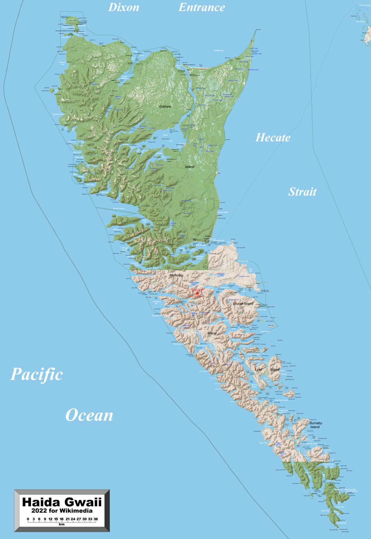
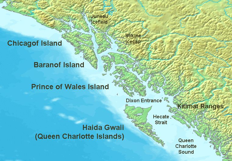
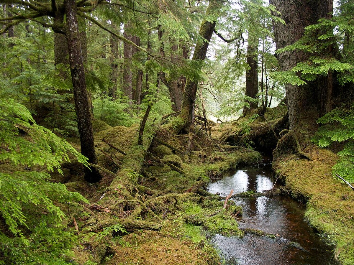
Haida Gwaii is located between 55 and 125 kilometres off the coast of British Columbia, separated from the mainland by the shallow Hecate Strait. To the north, the disputed Dixon Entrance separates it from the Alexander Archipelago in Alaska. The archipelago consists of two main islands, Graham Island in the north and Moresby Island in the south, along with roughly 400 smaller islands such as Anthony, Burnaby, Langara, Lyell, and Kunghit Island. The landscape is dominated by a coastal temperate rainforest, moderated by the North Pacific Current, which brings heavy rainfall and mild temperatures year round. This isolation has led to the evolution of many unique plant and animal subspecies.
The forests feature large trees including Sitka spruce, western red cedar, yellow cedar, shore pine, western hemlock, mountain hemlock, western yew and red alder. Soils are variable, with peat common in poorly drained areas and mature podzols in well drained locations. Major protected areas include the federal Gwaii Haanas National Park Reserve and Haida Heritage Site, which encompasses the southern part of Moresby Island and adjoining islands, and the provincial Naikoon Park on northeastern Graham Island. Access to Gwaii Haanas is minimal, requiring travel by boat or seaplane.
The islands' ecological history is deep. Research by Simon Fraser University suggests that around 55,000 BCE the area was likely a tundra and low meadow environment populated by grazing mammals like caribou and possibly mammoths, evidenced by dung eating fungi found in ancient peat. The Pleistocene glaciation receded from Haida Gwaii about 16,000 BCE, roughly 2,000 years earlier than from much of the coast. The archipelago is home to distinctive wildlife subspecies, often bearing the Latin suffix carlottae, such as the Haida Gwaii black bear, which is larger than its mainland cousin, and the Haida ermine, the smallest subspecies of ermine. The famous Kiidk'yaas, or Golden Spruce, a genetically unique yellow Sitka spruce, was a notable landmark near the Yakoun River until it was illegally cut down in 1997.
History and Archaeology
Archaeological evidence confirms human habitation on Haida Gwaii for at least 13,000 years. Underwater archaeologists from the University of Victoria are investigating stone structures discovered in 2014 on the seabed of Hecate Strait that may date back 13,700 years, potentially representing the earliest known signs of human habitation in Canada. The islands are considered a potential route for the first human migrations into the Americas along the Pacific coastal migration hypothesis. The rich resources of land and sea allowed the distinct Haida culture to develop and flourish over millennia. By the time of European contact in 1774, the Haida population was estimated to be roughly 30,000 people, residing in several towns and including slave populations drawn from other clans and nations.
The archipelago was first sighted by Europeans in 1774 by Spanish explorer Juan José Pérez Hernández at Langara Island. British captain George Dixon surveyed the islands in 1787 and named them the Queen Charlotte Islands after his ship, which was named for Queen Charlotte, wife of King George III. The islands played a central role in the maritime fur trade of the late 18th and early 19th centuries, dominated initially by American traders. The Haida actively defended their territory, capturing and sinking American vessels like the Ino in 1794 and holding the crew of the Georgiana for ransom in 1851.
The colonial era brought catastrophic population decline due to introduced diseases such as smallpox, typhoid, measles, and syphilis. The 1862 Pacific Northwest smallpox epidemic alone killed over 70 percent of the Haida people. By 1915, the population had plummeted to about 600, with survivors consolidating in villages like Skidegate and Masset or moving to cannery towns on the mainland. In response to increased American activity from a gold rush on Moresby Island in 1851, the British created the Colony of the Queen Charlotte Islands, though it was administered jointly with the Colony of Vancouver Island by Governor James Douglas.
Haida Society, Culture and Language
Traditional Haida society is organized into two main matrilineal clans, the Eagle and the Raven, each containing more than 20 lineages. Clan membership dictates social structure, marriage rules, and the inheritance of property and crests. The cross lineal marriage system between the clans was essential for building social ties, transferring wealth, and collaborating on projects like building longhouses and carving totem poles. Haida cultural identity is powerfully expressed through art, including the carving of totem poles, longhouses, masks, war canoes, and cedar boxes, which display inherited family crests. Potlatch ceremonies were and remain a focal point of Haida life, reinforcing social organization, status, and the interdependence of clans and villages.
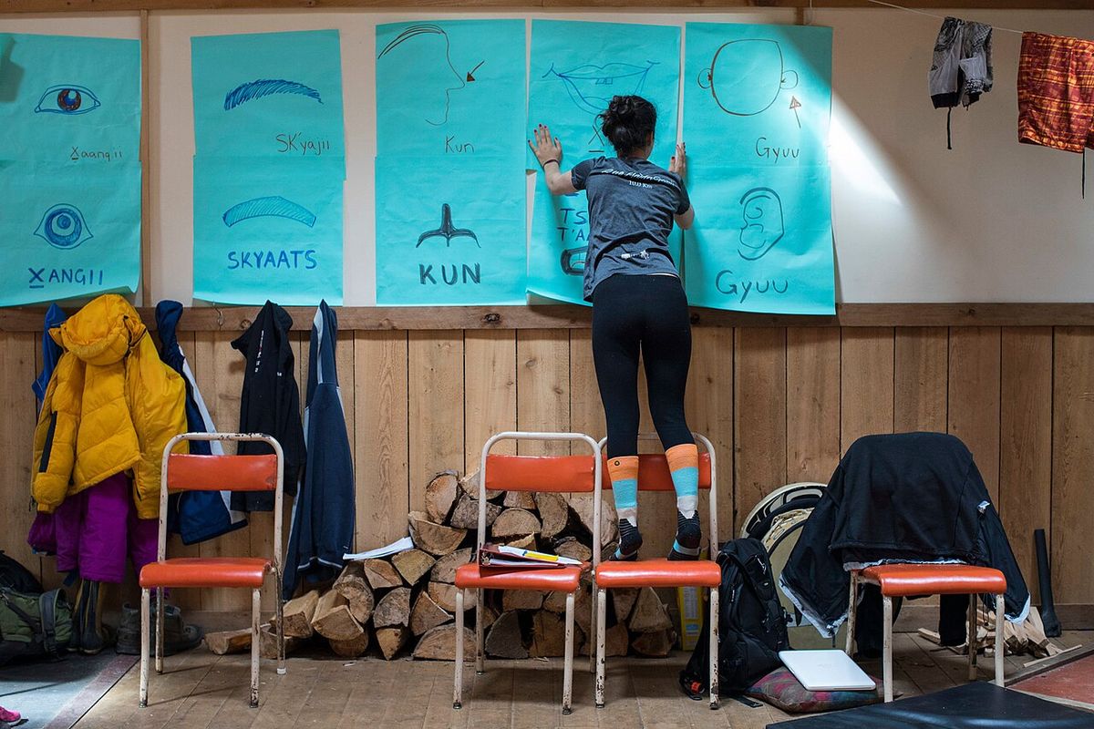
Lineages were property holding groups, owning rights to specific salmon streams, trapping sites, cedar stands, stretches of coastline, and house sites. The Haida were skilled traders and noted seafarers, with established trade links with neighbouring First Nations from the mainland to California, trading items such as eulachon fish. They also conducted raids using large sea going canoes as far south as Washington State. The Haida language is a linguistic isolate with two primary dialects: X̲aad Kíl (Masset) in the north and areas of southeast Alaska, and X̲aayda Kil (Skidegate) in the south. All 50 remaining speakers of Haida are over 70 years old. The Haida Heritage Centre at Kaay Ilnygaay in Skidegate serves as a cultural hub and offers educational programs in partnership with institutions like the University of Northern British Columbia.
- Social Structure: Matrilineal clans: Eagle and Raven, with over 20 lineages each.
- Cultural Expression: Totem poles, longhouses, masks, potlatches, crest art.
- Economy: Historically based on fishing, hunting, trade, and resource management of lineage owned properties.
- Language Status: Endangered. The 2021 census recorded 220 people with knowledge, but fluent speakers number less than a dozen for X̲aad Kíl.
- Art: The artwork Spirit of Haida Gwaii by Bill Reid was featured on the Canadian $20 bill from 2004 to 2011.
Governance and Political Advocacy
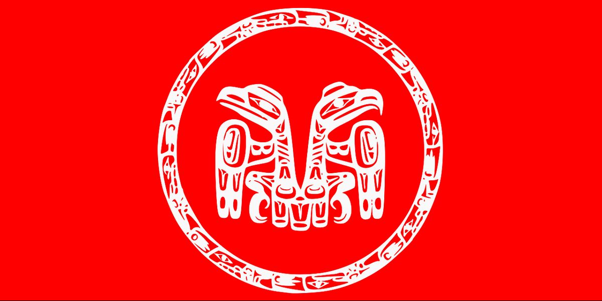
The Council of the Haida Nation (CHN) was established in 1974 with the mandate to strive for the full independence, sovereignty, and self sufficiency of the Haida Nation. It represents the collective will of the Haida people, working alongside the two village councils: the Old Massett Village Council and the Skidegate Band Council. The CHN has been a formidable political force, consistently asserting Haida title and rights to their traditional territories. Decades of negotiation and political pressure culminated in the historic Gaayhllxid/Gíihlagalgang Rising Tide Haida Title Lands Agreement signed with the Province of British Columbia in April 2024. This agreement marks the first time in Canadian history that a provincial government has recognized Indigenous Aboriginal title across an entire terrestrial territory outside of a court ruling. It follows court title recognitions for the Tŝilhqot’in Nation in 2014 and the Nuchatlaht First Nation in April 2024. The agreement was formally signed by Prime Minister Justin Trudeau and Haida Nation President Gaagwiis Jason Alsop at a public ceremony in Skidegate on February 17, 2025.
Contemporary Life, Economy and Infrastructure
Today, approximately 4,500 people live on Haida Gwaii, with the Haida people making up about 45 percent of the population. About 70 percent of the Indigenous population resides in the two main communities of Skidegate and Old Massett, each with about 700 people. The economy is mixed, historically reliant on natural resources like commercial fishing and logging. In recent decades, tourism has grown significantly, encompassing fishing guides, adventure tourism, cycling, camping, and Indigenous cultural tourism centred on the Haida Heritage Centre. Service industries and government jobs provide about one third of all employment. The Haida Nation actively works to build a conservation based economy, focusing on sustainable management of coastal forests and fisheries.
Public education is provided through School District 50 Haida Gwaii, with elementary and secondary schools in Masset, Port Clements, Daajing Giids, Sandspit, and Skidegate. The Old Massett Village Council operates Chief Matthews School, a K through 5 school expanding to grade 6 in the 2023 24 school year. Health care is delivered by Northern Health, with two main hospitals: the Northern Haida Gwaii Hospital and Health Centre in Masset opened in 2008, and the Haida Gwaii Hospital and Health Centre in Daajing Giids opened in November 2016. There are four British Columbia Ambulance stations staffed by approximately 36 casual emergency medical responders and one part time community paramedic based in Masset.
| Transportation Link | Type | Location/Details |
|---|---|---|
| BC Ferries | Marine | Skidegate to Prince Rupert (MV Northern Adventure). Skidegate to Alliford Bay (Moresby Island) |
| Highway 16 | Road | Westernmost leg of Yellowhead Highway on Graham Island (120 km of highway) |
| Sandspit Airport | Air | Primary airport on Moresby Island |
| Masset Airport | Air | Airport on northern Graham Island |
| Floatplane Services | Air | Connect to Alliford Bay and Masset Water Aerodromes |
| Moresby Island Roads | Road | Only 20 km of paved road along the coast |
Notable Events and Environmental Issues
Beyond the title agreement, several events have shaped modern Haida Gwaii. In July 2012, entrepreneur Russ George, with financing from the Old Massett Village Council, dispersed 100 tons of iron sulphate dust into the ocean west of Haida Gwaii in a controversial geoengineering experiment marketed as a salmon enhancement project. The Haida Salmon Restoration Corporation removed George as a director in May 2013 following charges of unscientific procedures and violations of international moratoriums. While the 2013 salmon runs increased, scientists found no conclusive evidence linking the increase to the iron fertilization, with research on 13 major open ocean experiments since 1990 concluding the method is unproven. The islands were also the site of a significant act of reconciliation through the formal name change, which involved a Giving Back the Name ceremony where the name was written on paper, placed in a bentwood box, and handed to the premier of British Columbia.
The archipelago contains significant cultural landmarks, most notably the village of Ninstints on Anthony Island (SGang Gwaay), a UNESCO World Heritage Site designated in 2006. The site is recognized for its preserved Haida village remains and memorial poles. The Haida continue to steward their lands through Guardian programs and sustainable economic initiatives. The islands are located along the Queen Charlotte Fault, an active transform fault that produces significant earthquakes every 3 to 30 years. Major earthquakes occurred in 1949 and 2012.
- 2006: SGang Gwaay (Ninstints) designated a UNESCO World Heritage Site.
- 2010: Haida Gwaii Reconciliation Act formally changes the archipelago's name.
- 2012 to 2013: Controversial ocean iron fertilization experiment conducted and later disavowed.
- 2024: British Columbia signs the Rising Tide Haida Title Lands Agreement, recognizing Aboriginal title.
- February 2025: Prime Minister Justin Trudeau and President Gaagwiis Jason Alsop formally sign the agreement in Skidegate.
- Earthquakes: Major seismic events occurred in 1949 and 2012 due to the Queen Charlotte Fault.
Questions about Haida Gwaii
Where is Haida Gwaii located?
Haida Gwaii is an archipelago located off the northern Pacific coast of British Columbia, Canada. It is situated between 55 and 125 kilometres from the mainland, separated by the Hecate Strait. The islands lie south of Alaska's Alexander Archipelago across the Dixon Entrance. The archipelago consists of two main islands, Graham and Moresby, and approximately 400 smaller islands with a total landmass of 10,180 square kilometres.
What does the name Haida Gwaii mean?
Haida Gwaii means "islands of the people" in the Haida language. It is a modern name created in the early 1980s to replace the colonial name Queen Charlotte Islands. The name change was formally enacted by the Haida Gwaii Reconciliation Act on June 3, 2010. An older Haida name, Xaadala Gwayee or Xhaaidlagha Gwaayaai, translates to "islands at the boundary of the world".
Who are the Haida people?
The Haida are an Indigenous nation whose ancestors have lived on Haida Gwaii for at least 13,000 years. Their society is traditionally organized into two matrilineal clans, the Eagle and the Raven, known for their rich artistic traditions including totem pole and longhouse carving. The Haida were skilled seafarers and traders. Today, Haida people make up about 45 percent of the islands' population of roughly 4,500. In the 2021 census, 4,260 people claimed Haida ancestry.
What was the 2024 Haida Title Lands Agreement?
The Gaayhllxid/Gíihlagalgang Rising Tide Haida Title Lands Agreement, signed in April 2024, is the first time a Canadian provincial government recognized Indigenous Aboriginal title across an entire terrestrial territory outside of a court ruling. This agreement transferred title over more than 200 islands off Canada's west coast to the Haida people. British Columbia completed this transfer in 2024 after decades of negotiation. Prime Minister Justin Trudeau and Haida Nation President Gaagwiis Jason Alsop formally signed the agreement at a public ceremony in Skidegate on February 17, 2025.
What is there to see and do on Haida Gwaii?
Haida Gwaii offers unique cultural and ecological experiences. Visitors can explore the UNESCO World Heritage Site of SGang Gwaay (Ninstints) on Anthony Island, which features preserved Haida village remains and totem poles. The Haida Heritage Centre at Kaay Ilnygaay in Skidegate is a major cultural attraction. Outdoor activities include fishing, kayaking, hiking in the temperate rainforests of Gwaii Haanas National Park Reserve, and wildlife viewing for endemic subspecies like the Haida Gwaii black bear.
How do you get to Haida Gwaii?
The primary transportation links to mainland British Columbia are via BC Ferries and air. BC Ferries operates regular service between Skidegate on Graham Island and Prince Rupert on the mainland. There are airports at Sandspit on Moresby Island and Masset on Graham Island, with flights from Vancouver and Prince Rupert. Within the islands, there are about 120 kilometres of highway on Graham Island and only 20 kilometres of paved road on Moresby Island.
Sources and further reading
- Haida Gwaii (Wikipedia)
- Council of the Haida Nation (haidanation.ca)
- Haida Nation (coastalfirstnations.ca)
- 'Groundbreaking': The Haida get their land back (thenarwhal.ca)
- Haida (thecanadianencyclopedia.ca)
Checked by the Nosy Mag desk. Last updated 2026-10-25.