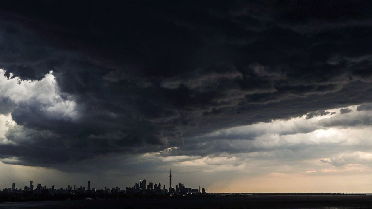
Toronto braces for another round of heavy rain and storms, but less severe than last week
Meteorologists predict another wet day for Toronto and the GTA on Wednesday, with potential localized flooding but less intensity than last week's damaging storms. While rainfall could reach 50mm in some areas, wind speeds and storm severity will be significantly reduced compared to the previous extreme weather event.
Toronto and surrounding regions are preparing for another bout of stormy weather just seven days after torrential downpours caused extensive flooding, downed trees and widespread power outages across the Greater Toronto Area. CityNews Chief Meteorologist Natasha Ramsahai has analyzed the incoming weather system and confirms it will be substantially less severe than the destructive storms that impacted the region last week.
Detailed weather timeline and conditions
The rainfall event will begin in the pre-dawn hours of Wednesday, with initial showers expected between 4 and 5 a.m. These early morning showers will persist through the morning commute before tapering off temporarily. The morning temperature will start at an unseasonably warm 18°C, nearly 7 degrees above the typical early September low of 11°C for Toronto. Humidity levels will steadily increase throughout the day, creating increasingly muggy conditions that will peak in the afternoon with humidex values approaching 35.
Following a several-hour break in precipitation during midday, rapid storm development is forecast around 3 p.m. This timing coincides with critical afternoon activities including school pickups and the beginning of rush hour. The most intense rainfall period will last approximately two to three hours, with meteorologists highlighting a specific lightning risk window between 4 p.m. and 6 p.m. The combination of saturated soils from morning rains and heavy afternoon downpours creates particular concern for localized flooding in vulnerable areas.
Regional precipitation variations
Rainfall distribution across the GTA will be uneven, with eastern regions including Toronto proper, Oshawa and Peterborough expected to receive the highest accumulations. These areas could see between 10-20mm of rain under the general forecast, but thunderstorms may produce hyper-localized downpours approaching 50mm in certain neighborhoods. Western portions of the metropolitan area will likely experience reduced precipitation totals, though all residents should remain weather-aware.
"If last week's severity was a 10/10, I am forecasting [Wednesday's] to be closer to five or six out of 10," Ramsahai stated, providing a clear comparison to the previous extreme weather event. This assessment considers multiple factors including rainfall intensity, wind speeds, and potential for structural damage.
Wind and severe weather potential
Wind patterns during Wednesday's storms will be notably less intense than those experienced last week. Forecasters predict sustained winds between 60-80 km/h across the region, with isolated gusts potentially reaching 90 km/h in western GTA communities. These speeds fall below critical thresholds for widespread infrastructure damage. "We start talking about the potential for wind damage and power outages at 90+ kilometres per hour, in the city, we shouldn't get there with these ones [on Wednesday]," Ramsahai explained.
The risk of accompanying severe weather phenomena remains relatively low. The probability of hail formation is minimal, and tornado potential is significantly reduced compared to last week's atmospheric conditions. This decreased severe weather risk should limit the types of property damage and emergency situations that occurred during the previous storm system.
Comparative analysis with previous storms
The incoming weather system differs substantially from last week's extreme event in several key metrics. Most notably, maximum wind gusts are forecast to reach only 90 km/h in isolated areas, compared to the 130 km/h winds that caused extensive tree damage and power outages seven days prior. This 30% reduction in peak wind speeds significantly lowers the potential for structural impacts.
Soil saturation remains a concern following last week's heavy rains, and the morning showers will further increase moisture levels in the ground. This preconditioning makes some areas more susceptible to localized flooding when the heavier afternoon rains arrive. However, the shorter overall duration and reduced intensity of this system should prevent the type of widespread flooding that overwhelmed storm drains and basements in the previous event.
Public safety recommendations
Residents throughout the GTA should maintain awareness of changing weather conditions throughout Wednesday. Those in known flood-prone areas should be particularly vigilant as the afternoon storms develop. Commuters are advised to allow additional travel time during both morning and evening rush hours, as heavy rain can reduce visibility and create hazardous road conditions even without extreme winds.
While the likelihood of widespread power disruptions is lower than last week, it remains prudent to prepare for potential outages. Charging mobile devices in advance and having emergency supplies including flashlights, batteries and drinking water available represents sensible precautions. Residents of basement apartments or properties with poor drainage should monitor for water accumulation and have sandbags or other flood prevention measures ready if needed.
Broader climate context
The recurrence of heavy rainfall events in the Toronto area reflects broader climate pattern shifts affecting southern Ontario. While Wednesday's forecast suggests a more moderate system, the increasing frequency of these weather events highlights infrastructure vulnerabilities in Canada's largest metropolitan area. Aging stormwater systems designed for different precipitation patterns are being tested by these repeated heavy rainfalls.
These weather patterns also demonstrate the nonlinear relationship between storm intensity and potential damage. Small variations in temperature, humidity and wind speed can create disproportionately different outcomes in terms of flooding, power outages and property damage. As Toronto continues to experience more volatile weather conditions, both municipal authorities and residents will need to adapt their preparedness strategies to account for these changing environmental realities.
Long-term weather outlook
Looking beyond Wednesday's storm system, Toronto's weather pattern appears set to remain unsettled. The combination of high humidity and variable precipitation creates conditions conducive to additional rainfall events in the coming weeks. While none of the immediate forecasts suggest storms as severe as last week's event, the cumulative effect of repeated rainfall on already saturated soils could exacerbate flooding risks in subsequent weather systems.